Primary School Offers - up to 60% OFF
Call 01-808 1494 to
Order
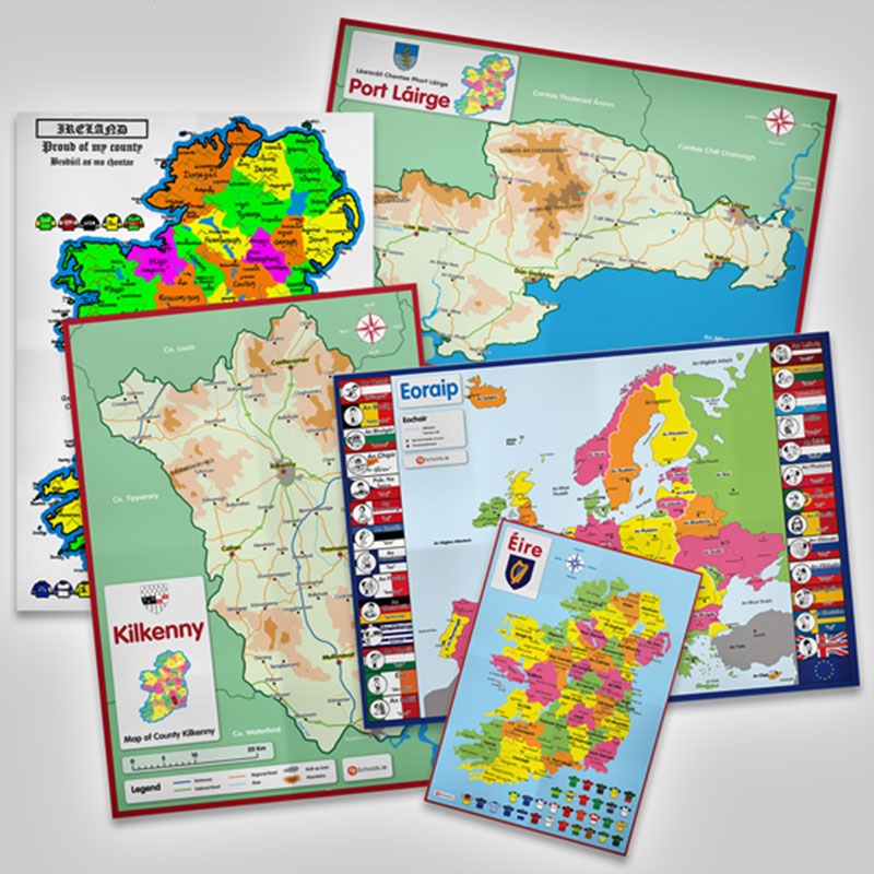
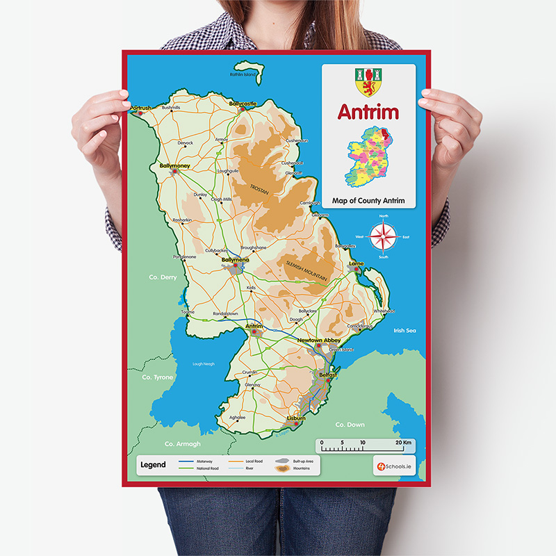
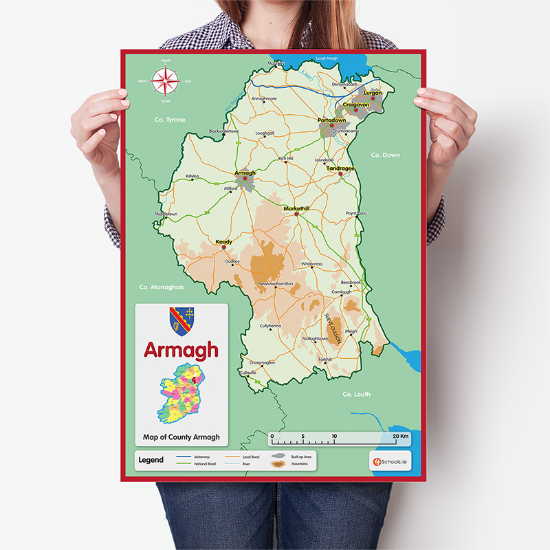
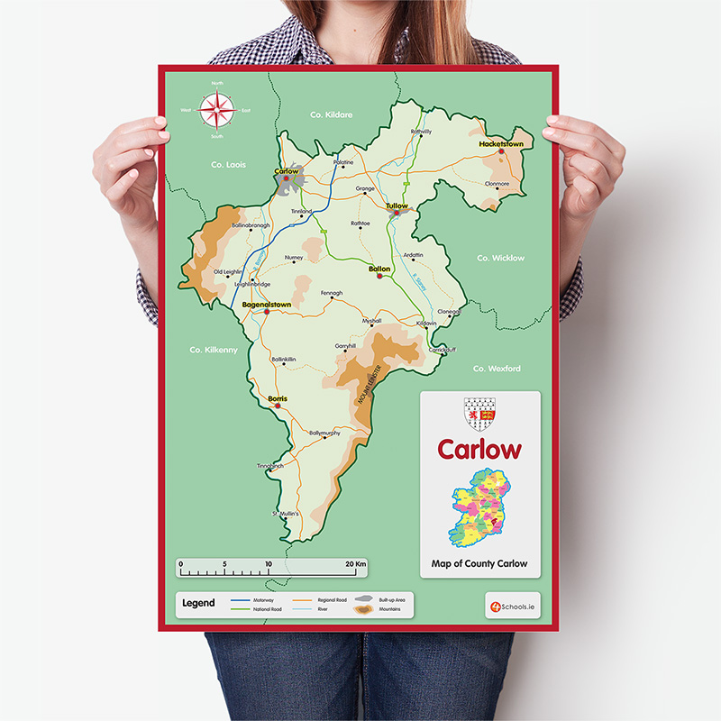
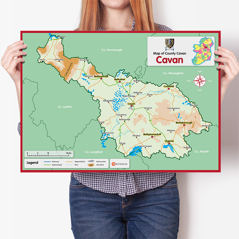
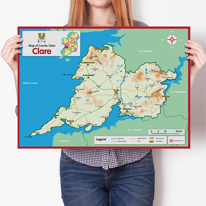
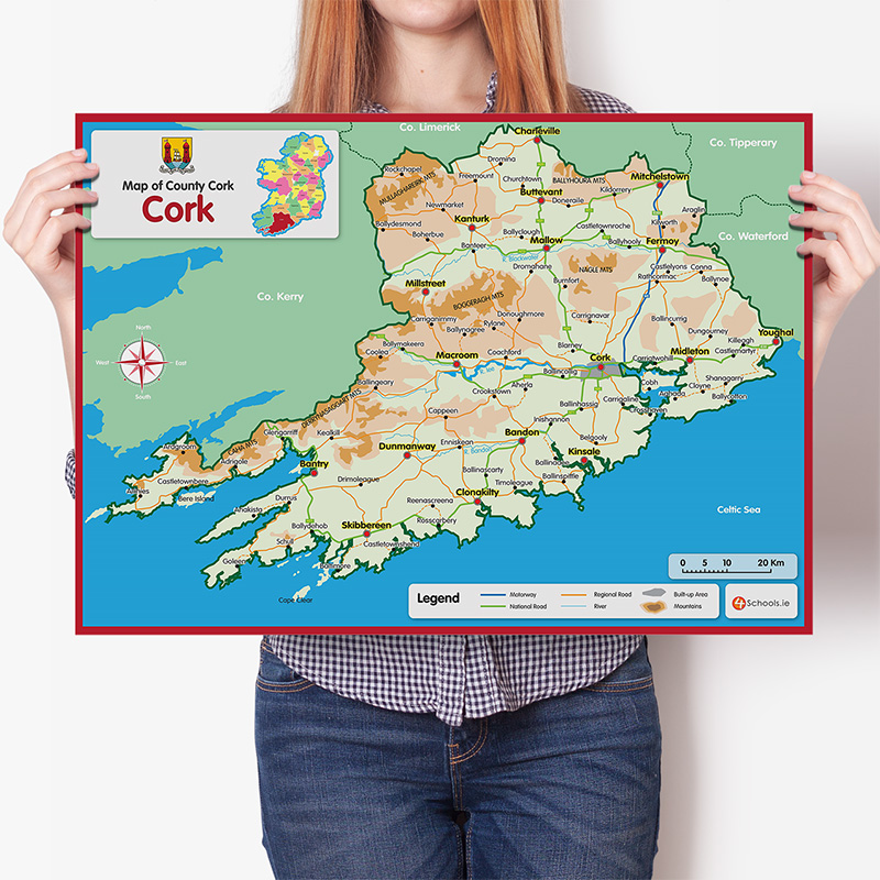
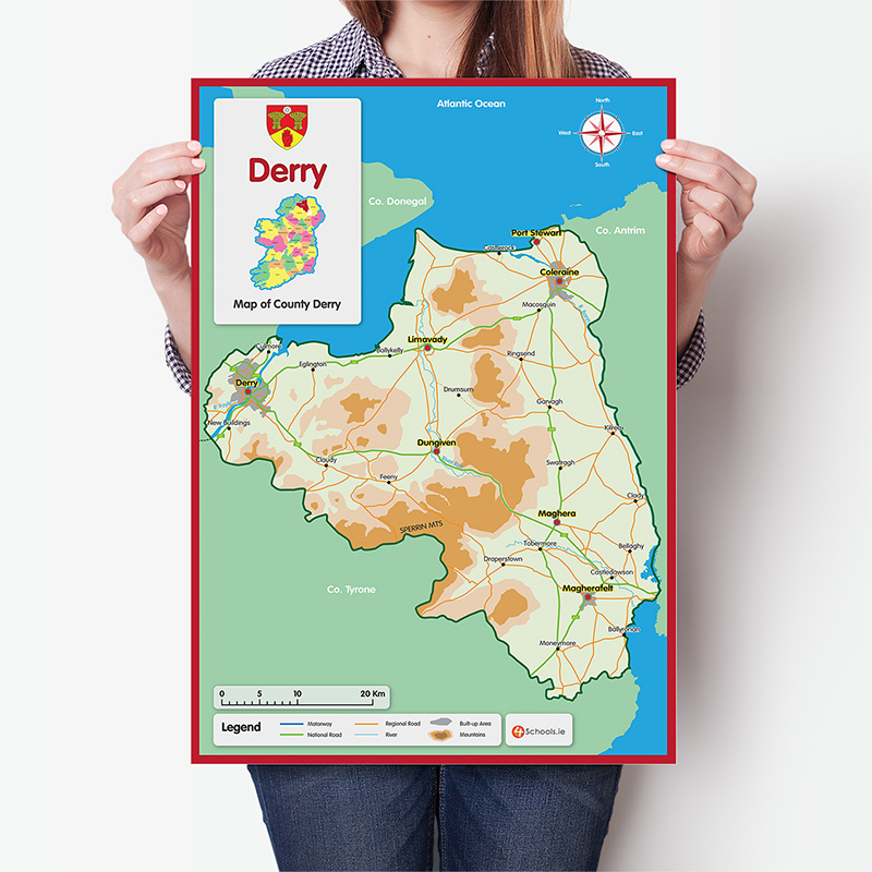
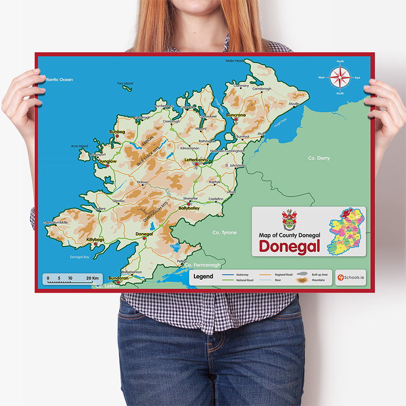
Make the teaching of physical geography to primary students easy with 4Schools maps of Ireland and Europe and the 32 counties of Ireland.
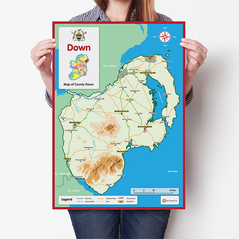
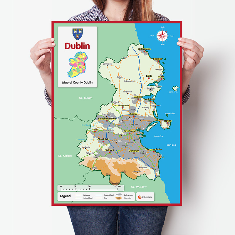
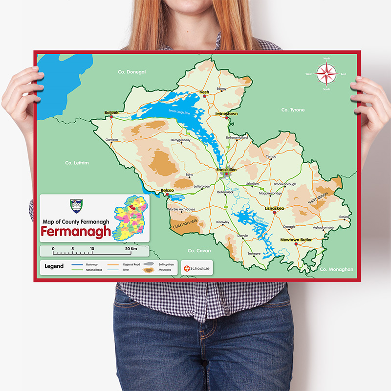
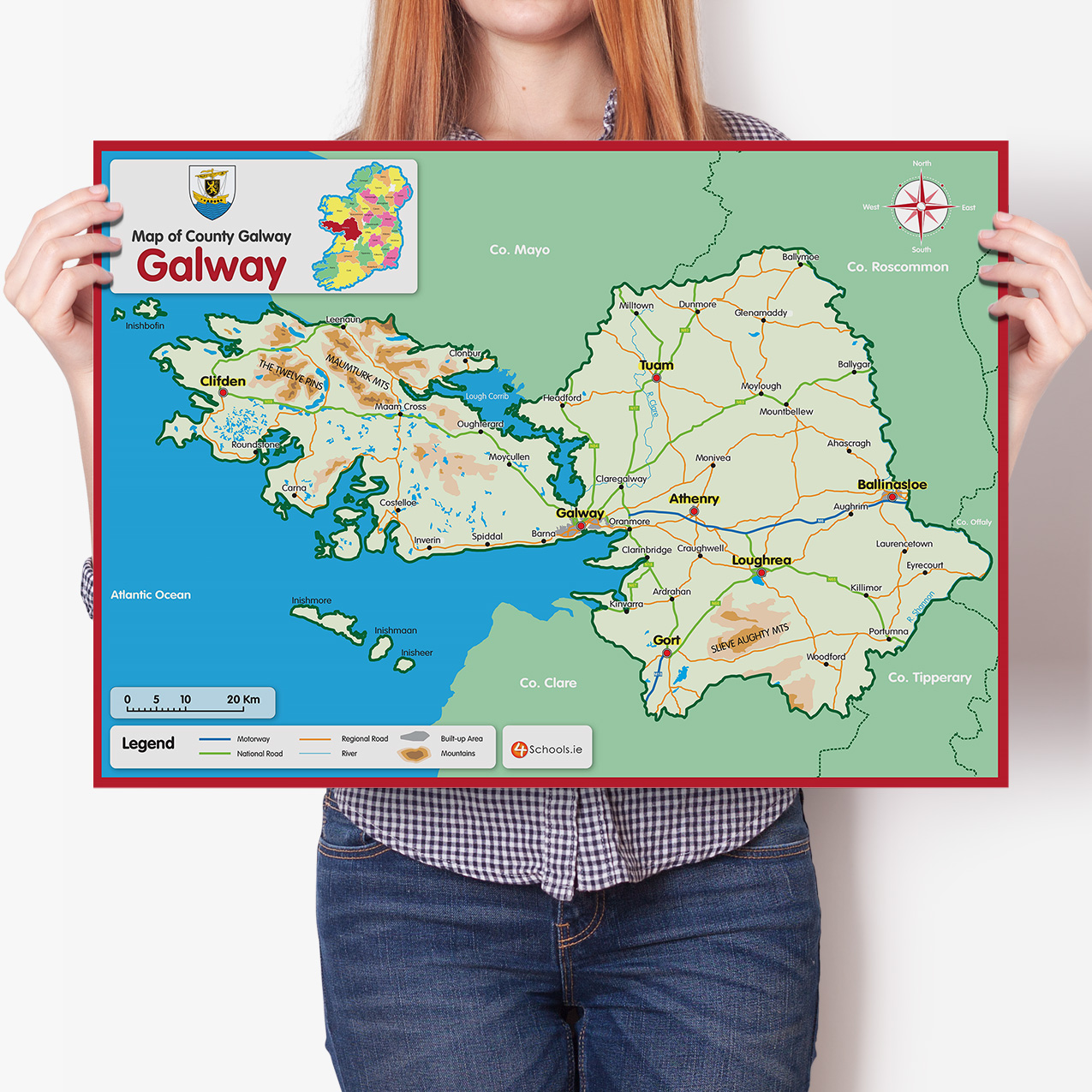
4Schools have created a range of high-quality, durable maps to support students in learning aspects of physical geography on the geography curriculum. Maps come in two versions; wall chart and A4 and are also available in Irish.
The A4 maps perfectly complement the wall-mounted version, allowing students to follow along with their teacher as they learn about different aspects of their own county and other counties of Ireland. They are an ideal resource for any primary classroom and contain cities, major towns, roads, rivers, mountains, and urban areas.
Each map is laminated, and the A4 County Maps are dual language, with English on one side and Irish on the other.
The range includes:
• Large wall chart maps of each of the 32 counties of Ireland
• A4 size maps of each of the 32 counties of Ireland (dual language)
• Map of Ireland with county jerseys and colours
• Map of Europe with country flags and 'Hello' in the country's language
All maps are available in Irish